Image
Short Description

The growth in computational resources now enables global weather and climate models to operate on the scale of a few kilometres. At this resolution, they can explicitly resolve storm systems and ocean eddies. The DYAMOND model intercomparison is the first project to perform a systematic intercomparison of these next-generation models. The ESiWACE flagship models IFS and ICON participate in the intercomparsion, and ESiWACE supports the intercomparison by providing data storage at DKRZ, resources for server-side processing and support in the use of the tools.
Objective

By supporting the DYAMOND intercomparison of storm-resolving global weather and climate models, ESiWACE facilitates the development of these next-generation models, and advances climate science. The intercomparison allows to identify common features and model-specific behaviour, and thus yields new scientific discoveries and increases the robustness of our knowledge and the models. At the same time, this intercomparison serves as a perfect test case for the high-performance data analysis and visualization workflows necessary for dealing with the challenging amounts of data that these models produce, allowing ESiWACE scientists to improve the workflows using real-world cases.
Result & Achievements

Currently 51 users from 30 institutions worldwide have access to the intercomparison dataset. A special edition in the Journal of the Meteorological Society of Japan is dedicated to this intercomparison, and more and more papers are being published also in other journals. Two hackathons supported by ESiWACE have brought the community together and have provided guidance to junior researchers.
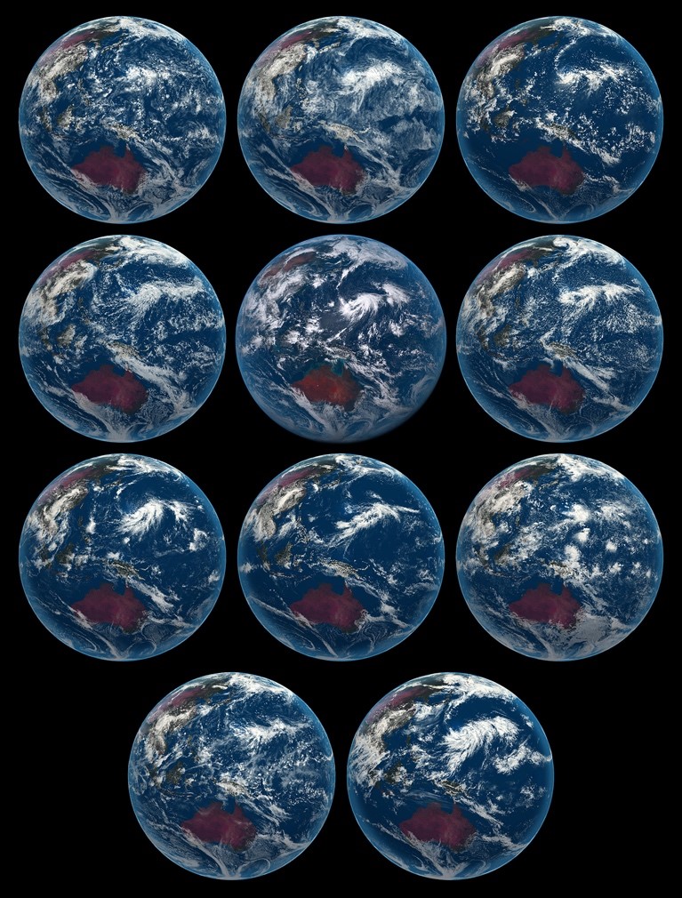
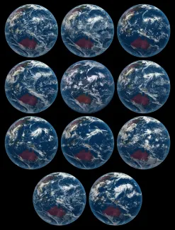
Snapshot of DYAMOND models. A snapshot of the models taken from the perspective of the Himawari 8 is shown. The images are for the cloud scene on 4 August 2016 and are qualitatively rendered based on each model’s condensate fields to illustrate the variety of convective structures resolved by the models and difficulty of distinguishing them from actual observations. From left to right: IFS-4 km, IFS-9 km, and NICAM (top row); ARPEGE, Himawari, and ICON (second row); FV3, GEOS5, and UKMO (third row); and SAM and MPAS (bottom row). For details see Stevens et al., 2019, PEPS.
Technologies
CDO, ParaView, jupyter, server-side processing
Use Case Owner
Collaborating Institutions
DKRZ, MPI-M (and many others)